Temagami Trip - 2009
The annual "Big Canoe Trip"... a tradition myself (Dan), and my sister Nita and brother-in-law Jorge
have maintained for many years. Traditionally, we had chosen Killarney, the crown jewel of Ontario Parks,
as our usual stomping ground. But we had paddled virtually every crook and cranny, if not every body of water,
and it felt like a good time to expand our adventures somewhere new.
And so, a fly-in trip to Temagami was chosen in the cold months of winter 2008/2009, and we began
the long process of patiently waiting and planning for the Big Trip.
Having only a week, including travel days, we decided the most efficient way to get to see the most
remote areas of Temagami was a fly-in trip, and paddle out. Our hope was that by flying into
the middle of the park, we would not see many other travelers, and get to see some very
scenic parts of the Lady Evelyn river and area.
To further save time, we planned for a boat
pick up at the end to avoid the long time-consuming paddle down Lake Temagami. The original
plan was to fly into MacPherson Lake, and paddle the Lady Evelyn River (north branch)
to Sharp Rock Inlet at the top end of Lake Temagami. But MNR flight restrictions
changed our fly-in starting point to Katherine Lake. This didn't change much, as we simply paddled
up stream to the Shangra La Falls area for the first night, rather than paddle south from
MacPherson.
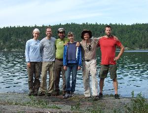
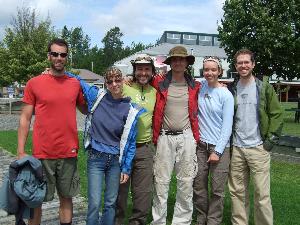
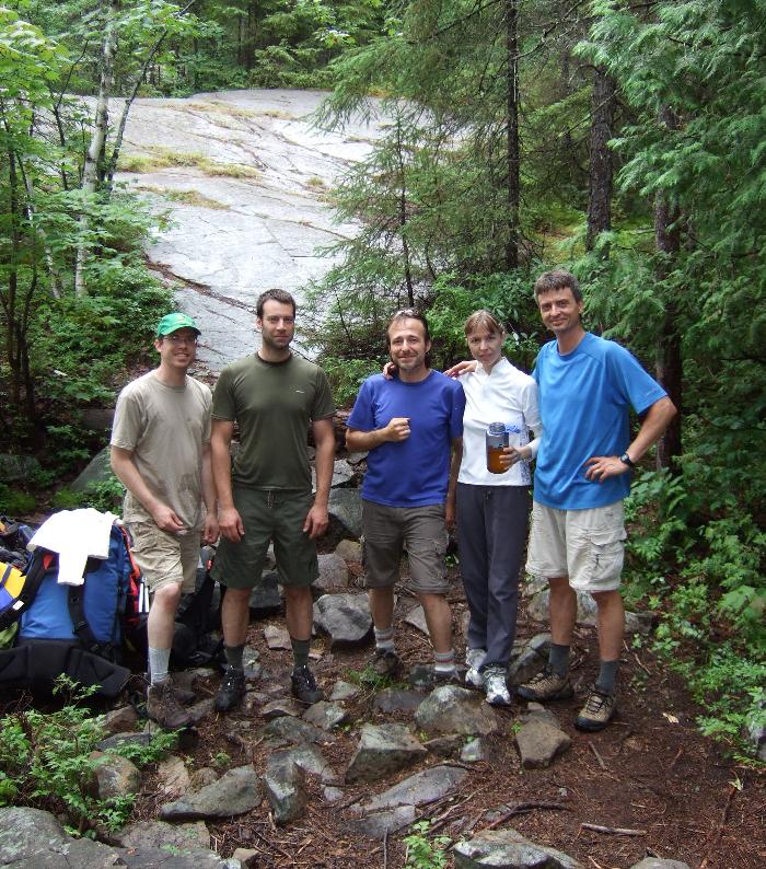
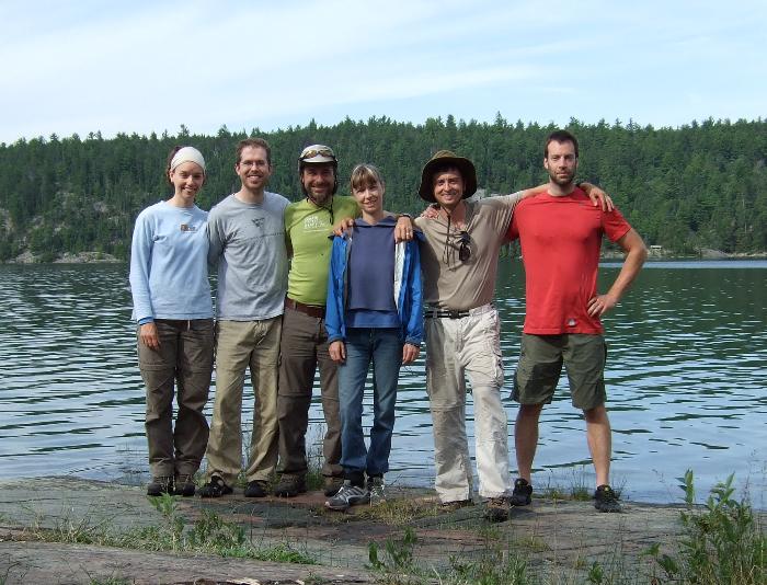
In the spring, a few friends asked to join our Big Trip, so we welcomed aboard
Brian, and Lee and his wife Sherri. This allowed us to enter the park in two flights,
with two canoes carrying each threesome.
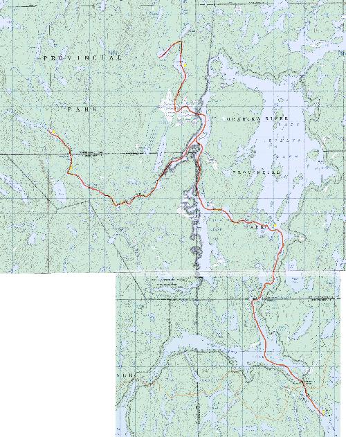
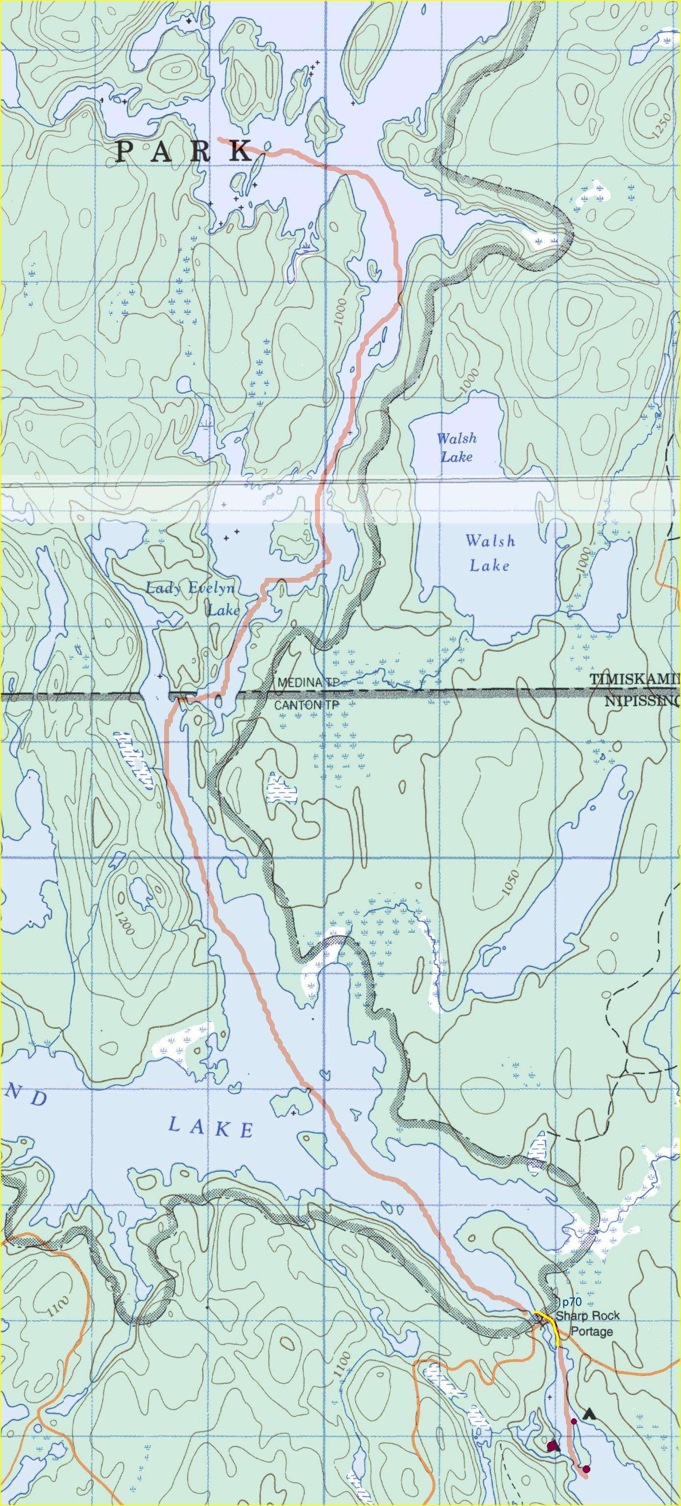
Trip Route map
Here is a
Large scale trip route topographic map showing the complete route.
And here is an interactive Google Map of the full trip (you can click on the map to zoom in and pan around):
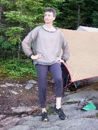
Day 0, Thursday July 23rd
We planned to have one open travel day to get to Temagami and start the trip the next morning,
but return home on the same day we exited the park. Dan, Nita and Jorge were able to leave early Thursday,
and we stayed in a local Motel in Temagami
(Temagami Shores Inn & Resort).
We received recommendations to dine at the one local Chinese
Restaurant, rather than the motel restaurant (and there were mighty few other options). This
unassuming restaurant (Orient Gardens) was a pleasant surprise, in that the owners
made excellent authentic Cantonese
food, that was both delicious and prepared fresh (along with other standard diner fare for the more
timid). Not something one expects from dot-towns "up north".
The following morning, we regrettably ate at the motel restaurant, which was both expensive
and a disappointment. It's hard to screw-up a basic breakfast, but they succeeded admirably and the
rubber sausages and cardboard pancakes did not travel far from the plates they arrived on.
The motel grounds were clean and tidy, which made the restaurant all the more of a let down.
Lee, Sherri and Brian left Thursday evening, so they stayed in North Bay and planned
to meet us at Lakeland Airways Friday morning.
Day 1, Friday
Fly with Lakeland Airways, from the town of Temagami, to Katherine Lake.
Paddle west (backward) to camp in Shangra La Falls area.
Topographic map: Lady Evelyn River North.
Topographic map: Shangra La Falls and MacPherson Lake.
The weather reports prior to leaving were not good at all, showing rain virtually
every day of planned trip. Friday morning brought drizzle and low cloud cover, which
delayed all flights out that morning.
That gave us lots of time to get sorted out,
finalize our boat pick-up plans with
Temagami Outfitting Company, as well as pick
up our rented SPOT device from them. Their store was extremely well stocked
in all the usual and necessary camping gear, and at surprisingly good prices...
no "up north" gouging! We didn't need any equipment, but it was good to see
such a well run and pleasant outfitter company.
|
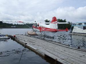
Sherri, Lee and Brian arrived around 9:30am, just in time for the weather to clear a bit,
allowing flights to go out. One flight went out before us, and then we were up.
Our pilot quickly directed us to load up our gear and then tied our canoe
to the plane's pontoon. With over a dozen flights that day, little time was wasted
on formalities and pleasantries. We would be dropped off on Katherine Lake
and wait for Lee, Sherri and Brian on the next flight.
(Click on the photos to see larger versions).
Here's a short 2 minute video on YouTube covering the
flight take off and landing.
The flight itself was exciting and lived up to our expectations of a remote wilderness
drop off (which none of us had done). There's nothing like paddling away as the plane takes off behind you,
the quiet sound of the wilderness slowly taking over the dying echoes of the engine.
|
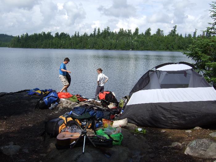
We were all gathered on the west end of Katherine Lake ready to start our trip before noon.
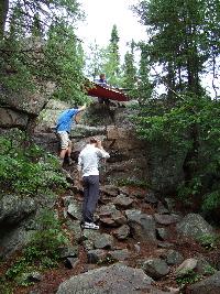
A short paddle up stream around the corner brought us to the first of many low-water rocky cascades
we had to portage around. Normally, you could line your canoe up these, but water levels
seemed very low, forcing us to into many carries along the boulder-sprewn shorelines.
There were no serious ankle injuries on our trip, but now I know why Kevin Callan
says the Lady Evelyn North river is only for the sure-footed!
Here's a short video that shows one of these many
shoreline boulder portages we encountered due to low water levels on the Lady Evelyn river.
It was also at this first cascade that we had the pleasure of first encountering
one lost member of the group we later nicknamed the "Crazy Ladies". Far off to the right
at the end of a marked portage that bypasses the Shangra La Falls area, was a lone women
shouting at us. We could not hear her over the cascade, but waved and planned to move
on past the cascade to camp along Shangra La Falls that first night. But the lady seemed a bit
desperate and alone, so we paddled over her way. After we called out "Hello" once in range, she
yelled back in greeting, "I was saying... do you see the rest of my group coming down the river?!"
My camping-radar went up, as something did not seem right with this person. Alone, separated
from her group, clearly frightened... not a good situation for a fairly remote area.
We told her no one was coming down the river, and asked her to confirm that this was the end
of the 725m portage from the top of Shangra La Falls. Turns out... she had no idea (no map, no idea where she was)!
Her group left her to take the portage alone, while they planned to boat down the river. I explained
that that was not possible, as Shangra La Falls is... well, a Falls! They would have to portage
along most of the Falls at best, with a couple rocky cascades like the one in front of us after that.
Well, none of this went over well for the Crazy Lady, who refused any help nor to backtrack and find her group.
So, we told her we'd keep an eye out for her group as we traveled up river, and let them know she was there.
And so, our allusions of a remote trip without human encounters was shattered within an hour
of starting after a 30 minute plane ride into the middle of what we thought would be "no where".
We later learned that this section of the Lady Evelyn River is extremely popular, especially
in the high summer season.
|
Past the next cascade's portage, we did encounter the remainder of the Crazy Ladies group, which
included an 80 year-old grandmother, a small terrier dog, and another women and her son.
Again, we tried the usual wilderness Hellos, and were met with a quick brush off. We told them
their companion was waiting for them a kilometer or so down river, and asked how they managed
to come down the Shangra La Falls. "Well, our map didn't show the Falls, so we had to portage most of it."
Which looked like fun given the mountain of gear in their beat up canoe.
Puzzled, I asked which map they had, which was met with, "It's what the outfitters gave us.. I know,
it's not the right one." Grandma gave us a sideways look, "We've had QUITE the adventure so far on
our trip! QUITE the list adventures for sure!" Later, we learned the only map
they had was the "Temagami Canoe Routes Planning Map", which
says right on the back, "This map brochure is intended as a general information and route
planning guide only." They had never taken a wilderness canoe trip before, had no knowledge or
experience in Temagami, and simply had shown up at the outfitters and were flown in and dropped
off around Florence Lake. Surely our pilot had made a mistake and accidentally dropped of
us off into a corridor lake in Algonquin Park!
|
|
The Crazy Ladies bounced their way down the shallow cascade, refusing to portage their mountain
of gear, and we ate lunch hopeful that would be the last of them we'd see.
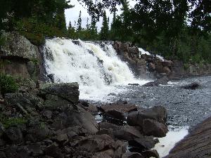
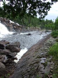
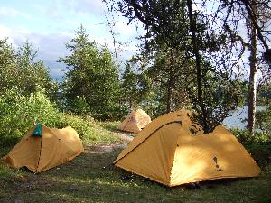
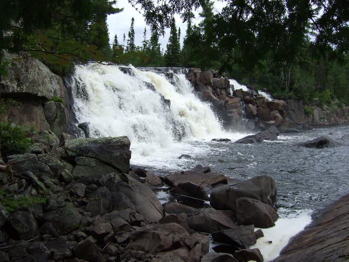
We were really looking forward to Shangra La Falls. The name alone conjures images
that any wilderness canoe tripper looks forward to. No one in the group
had ever camped next to water falls, and all the books and maps we had indicated
lots of prime spots to setup camp. And indeed, we were not disappointed...
The location was incredibly beautiful, with three sites right along the edge
of the three different drops along the falls.
|
|
Midway through setting up camp, a young fellow wandered into camp to say hello.
A nice guy, he turned out to be one of the leaders for a youth group of about 10 kids
camping at the Falls on their way north for a long circle trip through Temagami.
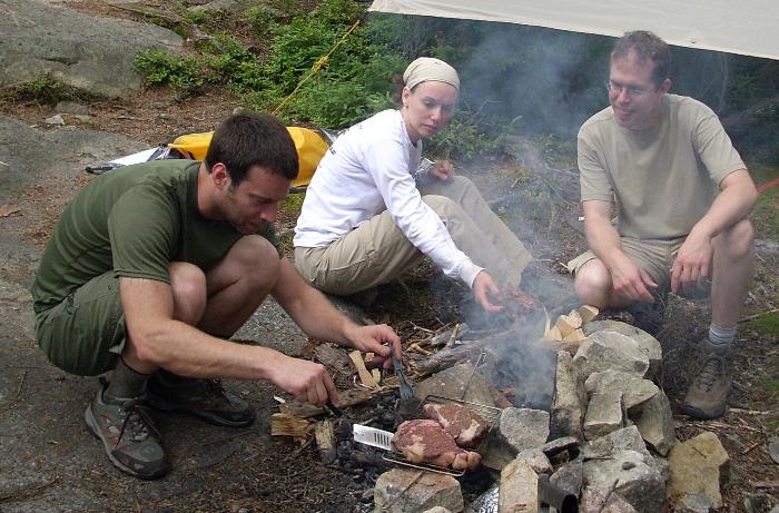
Later, as we prepared our traditional first-night frozen steak dinner, having stuffed
ourselves to maximum, we took one leftover steak and a couple baked potatoes down
the way to the youth group. They had started to cook their appetizing meal of
Mr. Noodle for 12 in a Large Pot over the fire, but the sight of steak and potatoes
brought drooling mouths like flies. The group leader was so happy, I thought
the guy might cry! They were midway through a long trip, and had long passed the days of fancy
meals. They all profusely thanked us for the gift, which we were more than happy to
provide, as it meant less for us to carry. It was nice to see such a well managed
and happy group of kids out on a "real" canoe trip. We left the group uplifted
after the negative encounter earlier in the day with the Crazy Ladies.
|
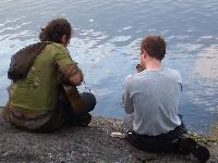
As the sun set after dinner, I trudged off up river a tad to fish in one of the drop pools.
Looking back at our camp, I saw Jorge setting up his hammock for a snooze. A moment later,
everyone had suddenly surrounded him while he was oddly laying on the rocky ground under
the hammock. More concerned about the fish, I ignored the event, later to learn that
Jorge had flipped out of the hammock and bonked his head pretty badly. The only thing
keeping him from going unconscious apparently was his frustration with Nita for chastising
him for being so clumsy! With Jorge's usual start-of-trip minor injury out of the way,
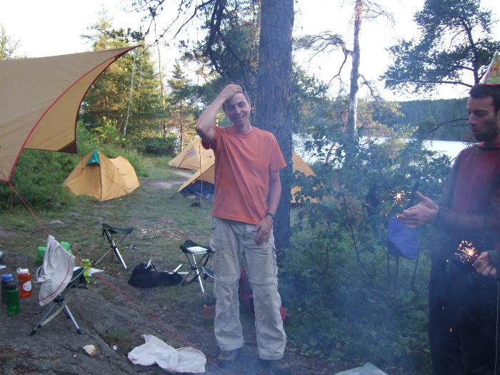
we had a fun remainder of the evening, at least until the bugs drove us all tent-bound by 9:30pm.
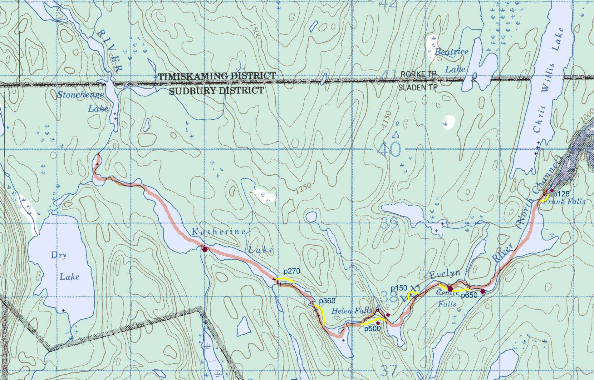
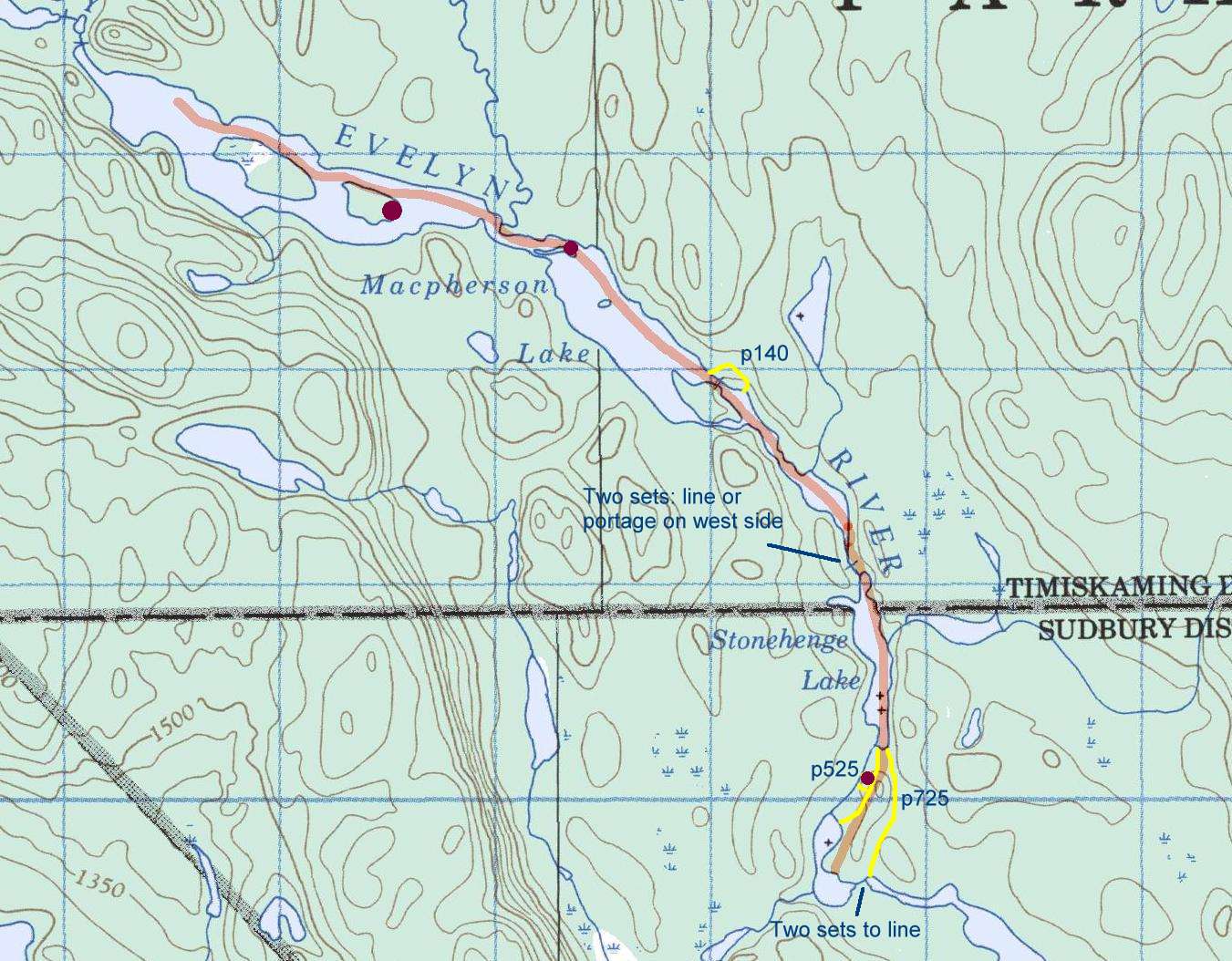
Day 2, Saturday
7k km total distance (from Shangra La).
Travel south, then east on Lady Evelyn River North, mid way.
p525 (Shangra La), p280 (North Channel entry), p360 (Lady Evelyn River), p500 (Hellen Falls), p150, p600 (Center Falls).
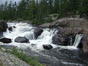
Camp at Center Falls.
We had managed to skirt the bad weather on our first day, with the skies clearing for our
flights, and remaining clear for most of the day. But we woke up to
a gray day, and knew that rain was coming eventually. Thankfully, the rain held off until we
had packed up camp, but it only poured more as the day dragged on. This was worrisome
given the difficult portages we expected at Helen and Center Falls.
Midway on the Helen Falls portage, we once again bumped into the Crazy Ladies.
They had stopped at the camp site half way along the trail. With cold rain pouring down
and a 80-year old lady and small dog in tow,
I thought they had made the smart decision to stop early at this excellent camp site.
"No, we're not stopping here! I guess you're racing us to the next camp site, I see.",
said the same Crazy Lady leader abandoned at the end of the portage the other day.
I guess my gently pointin that there were some difficult portages coming (since
they didn't have a proper map), and limited available camp sites further on, was
not welcome. We carried on to the steep sections at the end of the Helen Falls
portage, not sure how best to help their group.
|

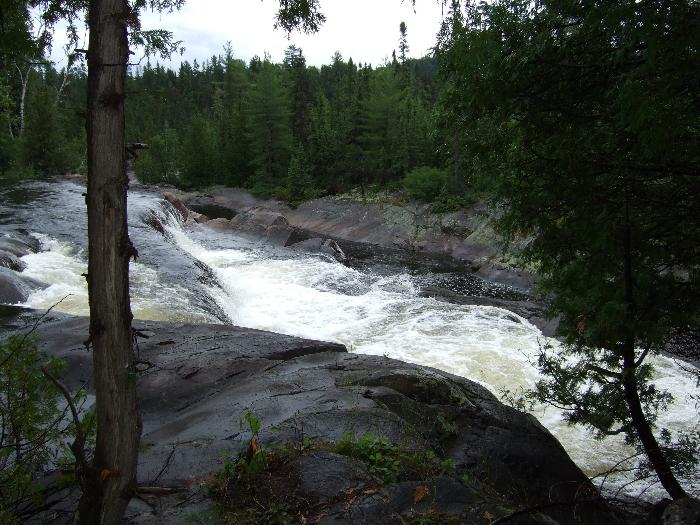
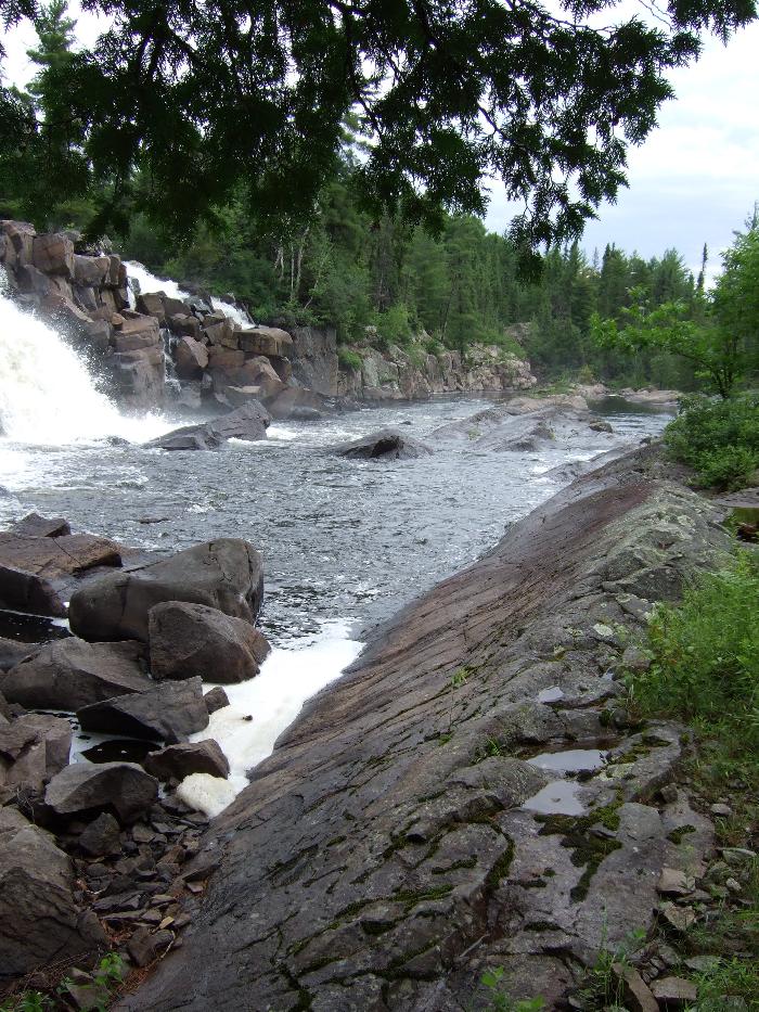
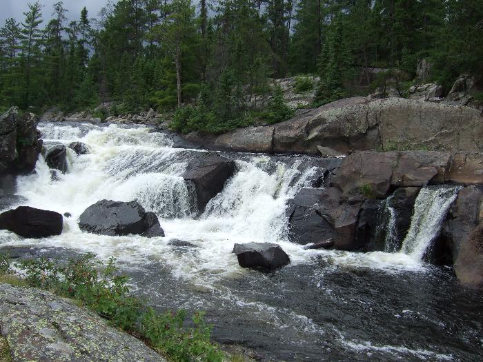
We carried on in the pouring rain to the last set of portages to Center Falls.
The camp site right on the edge of the falls was fantastic, and would have
been even more so in sunshine and warmth (it was surprisingly cold
for late July). With a veteran group of canoe trippers, little communication
was needed for people to simply go off and setup camp, everyone knowing
what to do for themselves and the group.
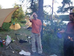
Camp setup, Brian and I bathed in a large eddie pool at the top
of the 50' falls, extracting a layer of sweat and grime.
Much to our surprise, we heard alarmed voices up river, as two canoes
came around the corner, only 100 feet from the fall's edge! The Crazy Ladies
were back.
|
|
We got out quickly and dressed, then returned to call them off from
continuing any further (I recalled reading stories of past canoeists
dropping over these falls to their death). Since they didn't have
a map and dreaded portaging their insane amount of gear, they must
have missed or disregarded the clear portage marker for Center Falls
and paddled down river. They bumped around desperately and managed to
land on the far shore, about 75 feet ahead of us. With the roar of
the falls, they were not able to hear us yell at them that there
was no way down the falls from that side of the river. Eventually, they
realized they were stuck and understood our directions to paddle the shoreline
into the easy eddie in front of our camp site. The son, dog, and Crazy Lady leader
bounced their way precariously with two complete canoe turns, but managed
by luck to avoid the falls and get into the eddie and land in front of us.
Incredulity turned into serious concern as I looked at the panicked glaze in
these two paddlers' eyes.
I told them there was another camp site across from the Falls, and that
we'll help them unload their gear here and then get them
safely setup.
They still had no idea how much trouble they
were in, as the lady refused to stop and rest for a moment and immediately started
walking the impassable shoreline back to their other canoe.
The dog took off, and I helped the guy unload.
Mainly, I just wanted to get them all safely on shore and rested,
as it was still pouring rain and quite cold.
|
|
Adam and I talked a bit about their "adventures" as we unpacked their
gear, which included a broken spear of a paddle, a 30 pound canvas-like
tent, and unending dry bags. They really had simply driven all the way
to Camp Wanapitei with no gear, no canoeing experience, no knowledge of the
area, and expected to be flown into Temagami and start their trip without a guide!
At this point, I said to Adam, "Dude, you realize you're in WAY over your heads here!"
He agreed, and said he'd never do it again. And at this point, we both realized the dog
had disappeared, so we started looking for it before it became a bear snack.
Eventually, the grandmother and remaining lady made their way down to the our
site, and we off-loaded their mountain of gear. The dog had miraculously found it's way
back to the other canoe through the woods, and came back with them.
Using calm voices, we did our best to sound reassuring and help them to
carry across the way to the other camp site.
I asked if they had any injuries (aside from the plethora of exposed scratches and cuts).
The leader Lady said, "Ya, I stumbled and bumped my head a couple days ago and got
a bad goose egg. But unless you have a medical drill to relieve the pressure, there's nothing
to do... I'm a doctor."
|
|

The other lady in their group soon became
very agitated and demanded we stop helping them with their gear, "You've done enough!
We can do this ourselves, thank you!".
So, we dropped their gear before the "staircase" down
Center Falls, shaking our heads.
We kept a good eye on the Crazy Ladies, making sure they got across the portage safely
and setup OK. The rain never let up much that evening, causing some very slippery rocks
all around the site. Unfortunately, Jorge had a
mishap with my 'camping' camera as he was
walking and shooting at the same time, which turned out to be a very funny
epitaph for a beat-up old camera that had seen so many trips! Alas, we had two other
cameras in the group to continue recording our adventures.
|
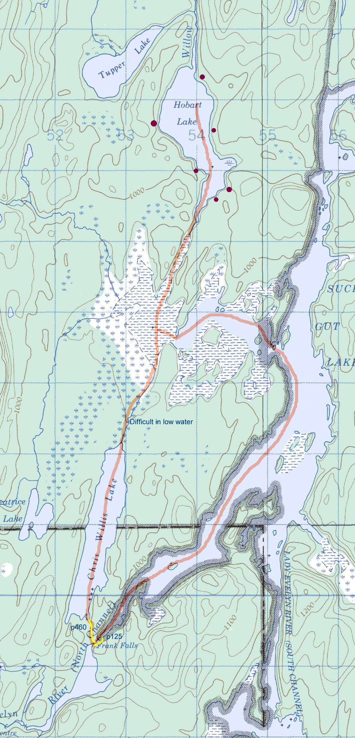
Day 3, Sunday
12 km, To Hobart Lake.
Topographic map: Lady Evelyn River to Hobart Lake.
|
The weather cleared somewhat the following day, giving us a bit of time to shake out our wet gear before
packing things up. The Crazy Ladies had left their canoes and paddles at our site, so we carried
them down the staircase and up to their site, along with our own gear (as the portage continued
through their site past Center Falls).
Along with the monstrous stand-up canvas tent that could sleep six
we could see from the Falls, they also had
a smaller two-man tent and a hammock tent (there were four of them, and a petite dog).
We asked how they were doing,
and they said their rented big tent flooded because they had set it up in a depression.
Having had a night to regroup, they started cursing at their outfitters, Camp Wanapitei,
resting the blame for their disastrous trip squarely on their shoulders, "I'm going to
sue them when we get back! How could they send us out without a good map!" We had
three copies of the standard Chrismar Temagami 2 canoeing map, so I left them our copy.
They were upset that I would not take payment for the map, asking only that they
take the remainder of their trip more carefully and please be safe. They told
us that they had borrowed a satellite phone from another group a few days back and made
arrangements to be picked up by plane on Lady Evelyn Lake in two days, as there was no way they
would be able to paddle back to Temagami as originally planned. We wished them the best,
and carried on our way assured they were as safe as could be expected, and thankful
we'd not see them again.
|
|
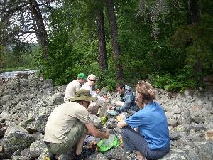
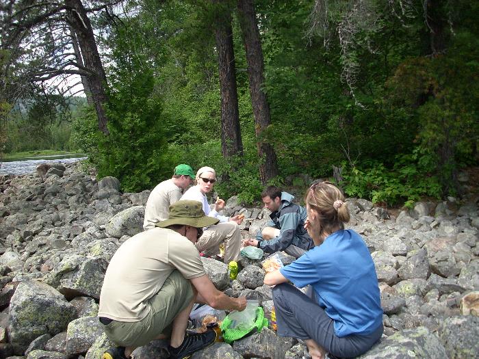
 We stopped at Frank Falls midday, hoping to wolf down lunch before the inevitable rain
came down from the threatening gray skies. A couple in a boat motored up from Sucker Gut
Lake, with similar lunch plans. We had a pleasant chat, then returned along the portage
to collect some of the plentiful blueberries. One full nalgene later, our group
dragged Nita and myself off of the bushes, surely some genetic addiction we both inherited
from our mother who grew up in the blueberry rich fields of Lake St. Jean in northern Quebec.
We stopped at Frank Falls midday, hoping to wolf down lunch before the inevitable rain
came down from the threatening gray skies. A couple in a boat motored up from Sucker Gut
Lake, with similar lunch plans. We had a pleasant chat, then returned along the portage
to collect some of the plentiful blueberries. One full nalgene later, our group
dragged Nita and myself off of the bushes, surely some genetic addiction we both inherited
from our mother who grew up in the blueberry rich fields of Lake St. Jean in northern Quebec.
|
|

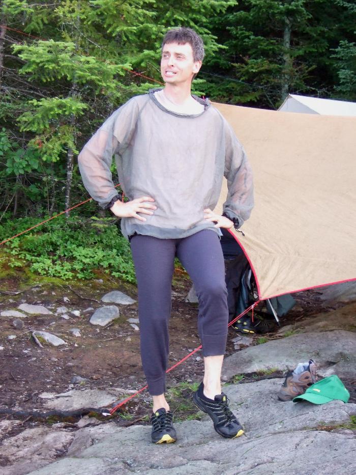
Several hours later we arrived at Hobart Lake, along with some welcome sunshine and warmth to
dry out our wet gear. Unfortunately, the mosquitoes had similar plans, and there was not a
breeze in sight to keep them at bay. Those who packed light on clothing, like myself, were
down to wearing underwear and bug jackets... a sight for (making) sore eyes.
We setup camp, and while someone else had dinner responsibility that evening, I cast off
for some fish. As often happens, I landed a whopper bass right away, but despite continued
efforts by myself and others, nothing else was caught. So, we had a delicious appetizer
with our dinner. And after dinner, the blueberries we picked up earlier were put to
good use in blueberry turnovers.
|
|
A ritual of attempting to start the campfire sans fire starter sticks became the evening challenge
for "the men", despite the complete lack of anything resembling dry cellulose material, otherwise
known as "wood".
Clearly, the "women" knew better and enjoyed the comedy from the sidelines, although
perseverance eventually paid off with much smoke and little flame (not a bad combination for
warding off bugs though).
Our big plan was to camp two nights on Hobart, allowing plenty of time to hike
Maple mountain the next day.
|
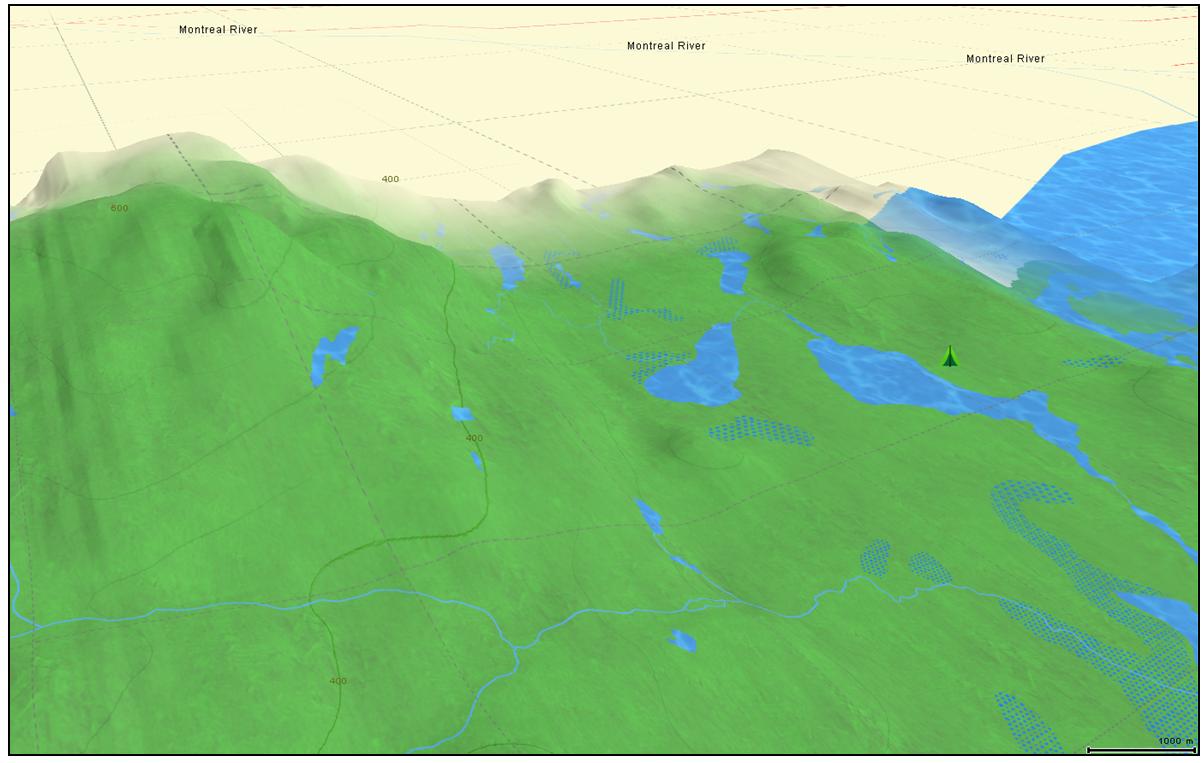
Day 4, Monday
Maple Mountain hike from Tuper Lake.
4 km paddle to hike starting point. 2.2 km hike to top of mountain (13 km round trip).
3D map of Maple Mountain and hiking area.
More gray skies threatening rain, no wind, and lots of bugs. This became the
summary of every day, up until the morning of the last day when we had our
first truly beautiful sunny day. Oh well... a day of bad weather camping is better than
a sunny day doing anything else!
The hike up Maple mountain was different from other wilderness hikes I had done, such
as those in Killarney. The bush was very dense, providing a much greater
enclosed tunnel sensation for most of the journey. Only nearing the very top of
the mountain do you come out onto exposed rock face, climbing a precarious
metal ladder to the open plateau of the peak.
While rain held off, the skies were still very ominous, so we ate lunch
quickly and planned to leave the same. That was until Nita and I started on
the blueberries again, which were even more numerous than the other day.
So, over an hour later we were dragged off the mountain top again,
with a nalgene replenished to the brim with the magic blue life force, and
plans for blueberry jam and muffins for breakfast.
|
Despite the poor weather, we encountered several other small groups both on
our way up, down, and on the mountain top. The view was spectacular, especially
from the fire tower, which Jorge, Lee and Brian climbed. Sherri, being a trained
field biologist, stopped occasionally along the route up and down to show us unique flora
and insects. It was very interesting to learn the official names to these
critters and plants which I had seen hundreds of times in past trips
and had simply ignored.
Back at camp, Lee and Jorge, the musicians in the group, broke out the guitar and
harmonica. The sounds echoed across the still evening lake, and mosquitoes even joined
in the harmony (buzz buzz, bite bite, slurp slurp).
|
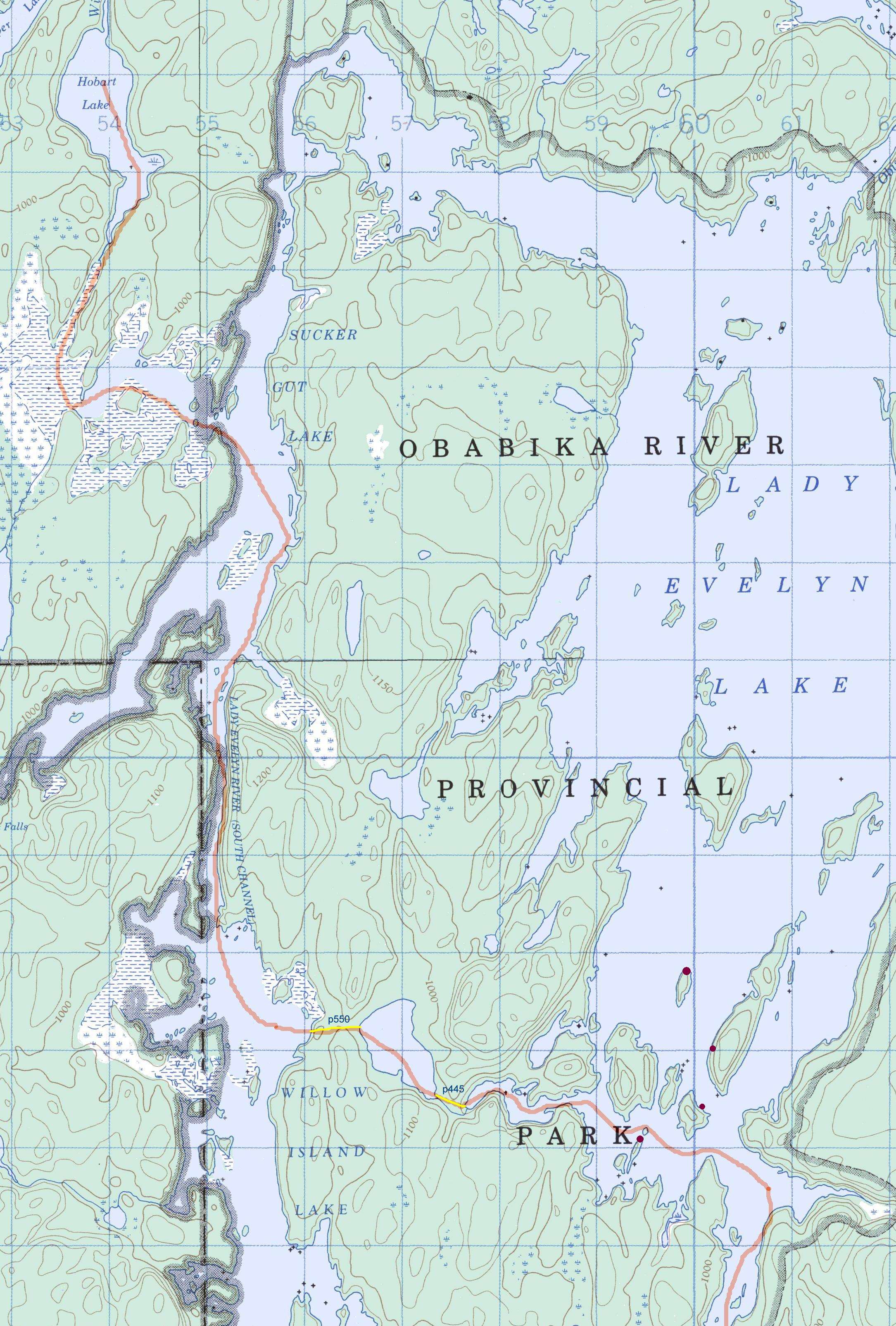
Day 5, Tuesday
15 km south to Lady Evelyn Lake (south end), through Willow Island Lake.
p500m, p490m.
Camp in the southern inlet of Lady Evelyn Lake.
Topographic map: Hobart to Lady Evelyn Lake, south end.
|
Another gray day, rain last night, and the dank smell of wet clothes in the tent.
Who's on for breakfast! A long day of paddling ahead of us to get to the south end
of Lady Evelyn Lake. But, by mid day the weather cleared to sunny skies... which of course
brought some substantial wind from the south-west on Willow Island Lake, making for some
tough paddling.
We saw a plane circling over us on Willow Island Lake a few times, but it carried on.
Later, we realized that it was probably Lakeland airways looking for the Crazy Ladies.
We had seen a canoe way off in the distance, so we hoped everything worked out in the end,
as we never saw the plane land.
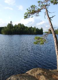
We were amply rewarded though by an outstanding camp site on an
island with beautiful sunny skies by late afternoon, high enough and with
enough wind to keep the bugs at bay. Within an hour, every rock
stump, and line in sight was festooned with outdoor clothing of every sort.
|
|

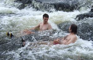
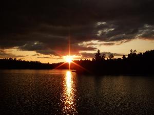
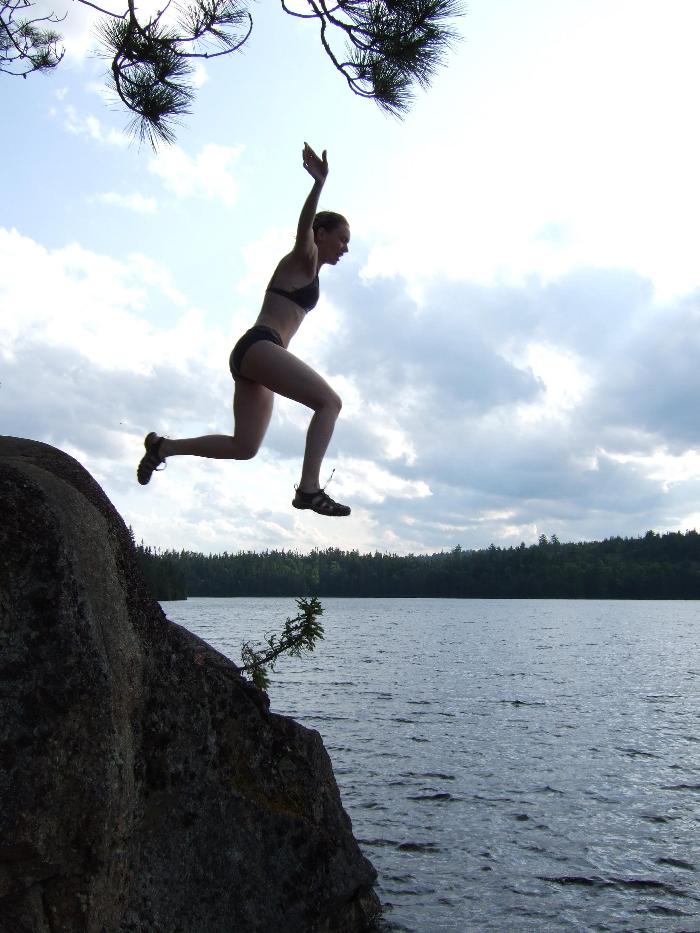
The site had a superb jumping rock with a deep pool at the bottom, and although the water was
unusually cold, most of the group took turns leaping to the frigid waters
below. Which turned out to be a good thing, because the weather suddenly soured
and dumped buckets of rain and wind for a few minutes. The usual mad-dash
to collect all the clothing ensued just in time. The storm passed on
quickly, bringing back a beautiful sunset with dark clouds far off in the distance.
|
|
I was a bit sad to think there was only one day left in our Annual Big Trip.
The group was getting along fantastically, having great fun despite the
challenging conditions. Every trip seems too short, but at the same time
I always look forward to seeing my wife and kids again. The latter condition
only improved by the Annual Family Canoe Trip which happened a month later
in Massasauga Park 2009 (with wife and kids in tow).
|
Day 6, Wednesday
15 km, South to Sharp Rock inlet.
Topographic map: Lady Evelyn Lake to Sharp Rock Inlet.
Boat pick up in this vicinity Thursday morning.
It's my birthday! A first, and special treat, for me to be out canoe tripping on my birthday,
thanks to my understanding and accepting wife. The weather hints at the possibility of
no rain, but we are conditioned for the worst, and head out quickly after breakfast.
|
The pleasant weather and less open waters made for a very enjoyable day of paddling, and
even the afternoon winds were behind us for the most part on the east end of Diamond Lake.
Crossing over from Diamond Lake to Sharp Rock Inlet at the top of Lake Temagami,
we felt the obvious change from Park lands to cottage country: lots of boats and cottages.
We found an obvious camp site that was marked on our maps, unfortunately nestled close to several
cottages.
|
The site itself was filled with debris and refuse. A pet peeve of mine, I spent the better part of
an hour bagging up the litter for the boat ride out tomorrow.
Oddly, most of it was about a meter off the ground in trees and scattered
randomly everywhere. A couple smaller pines tree covered in used toilet paper at waist height
provided the obvious clue: winter use, probably from snowmobilers. This site
was is stark contrast to all other sites within the official Evelyn Lake Park boundaries though,
which were generally exceptionally clean and well maintained.
|
I returned from my garbage collection to find everyone huddled hurriedly around the fire pit.
As I walked up, I was serenaded with "Happy Birthday!" and sparklers for all! I was completely
surprised by this, yet very happy: to be with good friends and family on your birthday
in a beautiful wilderness setting... it doesn't get much better. Nita baked us an angel food cake
that evening, which turned out delicious.
|
|
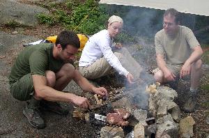
In fact, all the meals on this trip were outstanding. With a veteran group of
outdoor trippers, we simply assigned out all breakfasts and dinners equally. With three
dehydrators amongst us, the breadth of meals and snacks was outstanding. Brian got top marks for
Most Creative Dinner with his Szechwan noodles from dehydrated fish and veggies that
last evening. For the curious,
here is the recipe.
|
Day 7, Thursday
Morning pick-up by boat to return to Temagami docks.
Drive from Temagami back to Toronto.
|
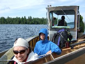
We had arranged with Temagami Outfitters to be picked up by boat in Sharp Rock Inlet
on the last day. We had also rented a SPOT device from them, and added them to the e-mail
list for our GPS location notifications. So there was no problem for them to find
us that morning. The 1.5 hour boat ride saved us one or two days of tedious paddling
through crowded cottage country, and was well worth the expense.
|
|
Brian, Lee and Sherri had to endure our tales throughout the trip of the unusually good Cantonese food
to be had at the Orient Gardens in the town of Temagami,
so after we had packed up, we all headed there for lunch.
As we had promised, the food was unusually fresh, plentiful and superbly prepared.
Furthermore, the homemade pies for dessert turned out to be incredible, from the coconut pie
to apple pie! Not what you expect when you walk into this modest looking establishment.
And with sad good-byes, each group packed up and headed off for the long
drive home, filled with great memories of another fantastic canoe trip.
|
Would I return to Temagami? Probably, but not urgently and most likely not for
a few years yet. We had hoped and expected a reasonably
remote trip, but ended up seeing people everyday of the trip, and on every portage.
Lake Temagami itself is busy, congested with boat traffic, and full of cottages.
The flight was expensive, and we mistakenly thought it would fulfill the
remote aspect we were after for this trip. I've experienced far less crowds
in Killarney, once you get past Three Narrows Lake, or up into Great Mountain and
beyond. The geography of Temagami is basic northern wood lands and scenic, but
not the stunning quartz rock formations and Canadian Shield of Killarney.
And the Crazy Ladies... I checked in with Lakeland Airways, and indeed
they had been successfully evacuated a couple days earlier. Although
the person in the office noted,
"The pilot said they definitely did not seem too happy though, and not too friendly!"
No surprise there.
|


