Chiniguchi Canoe Trip - July 2013
Trip planner for 2013 "Big Trip"!
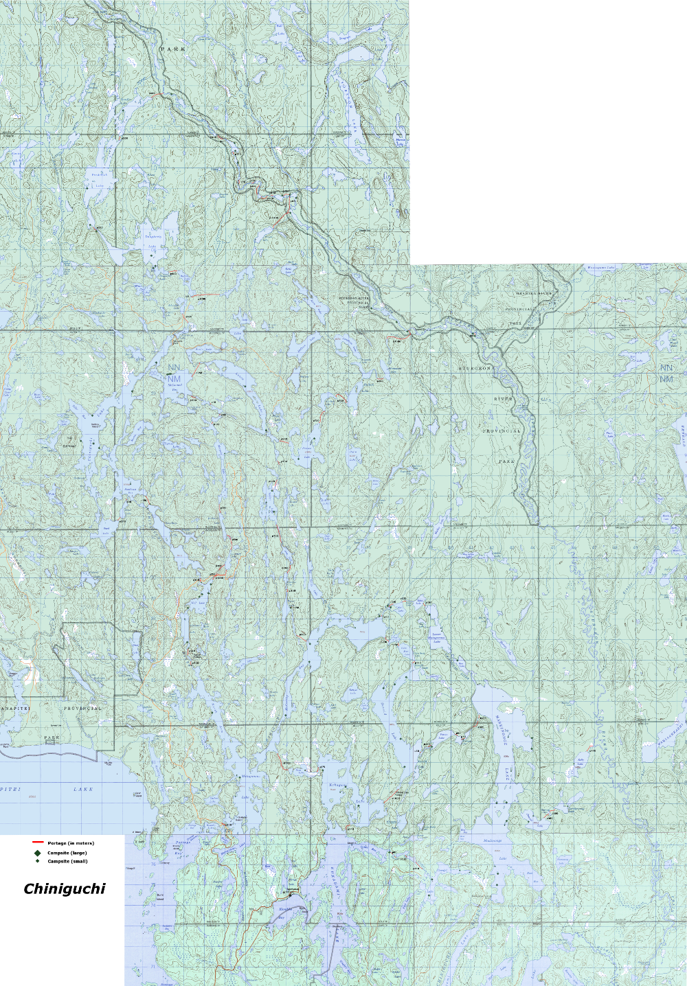
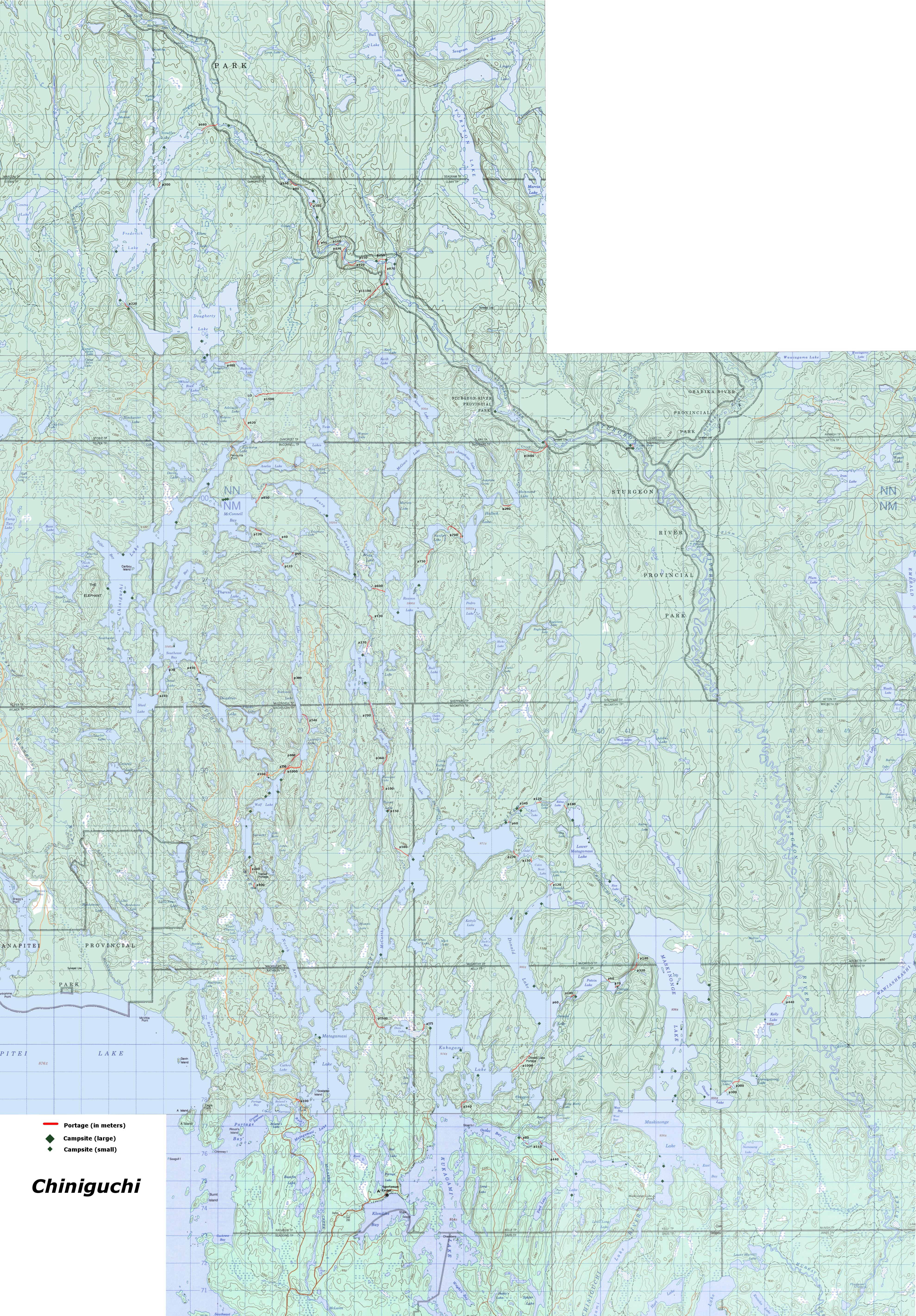
Large-scale maps of Chiniguchi
small-scale detailed area map covering all routes below, with portages and campsites noted: 3 meg.
Large-scale detailed area map covering all routes below, with portages and campsites noted: 30 meg.
Route: Sturgeon River, 109km
Alternate Route #2: Chiniguchi and Sturgeon River
As shown, allows for one layover day along the route as we see fit.
Alternatively, we could shorten a couple of the days, and make it an 8 day route (see route #3).
To lengthen the trip to 8 days, we could: day 2 Marjorie (there is apparently a small camp site on it),
day 3 Doughterty (many camp sites), then connect to remaining trip on Sturgeon, to make 8 days.
Regardless of 7 or 8 days, this is a hard trip! I'm a bit worried about what the Sturgeon River would be
like, but online sources promise me it's not bad at all:
MYCCR Sturgeon River discussion.
Overall, I think this trip would be extremely remote, quiet and very adventurous (but long)!
We need permits for the nights we camp on the Sturgeon River (like when on the Lady Evelyn River in Temagami). Call: 705-569-3205 Finlayson PP in advance to purchase, and get mailed to us.
Day 1, Sun. July 21, Wolf Lake
Leave Toronto 6am.
Arrive at Lakeland Lodge at 2-3pm. Park car there ($5/day)
Wolf is a popular lake, and we arriving late. But, We're coming in on a Sunday, so I expect it won't be too bad (and there are lots of camp sites).
13km: p100, p300, p240
Map of this day only
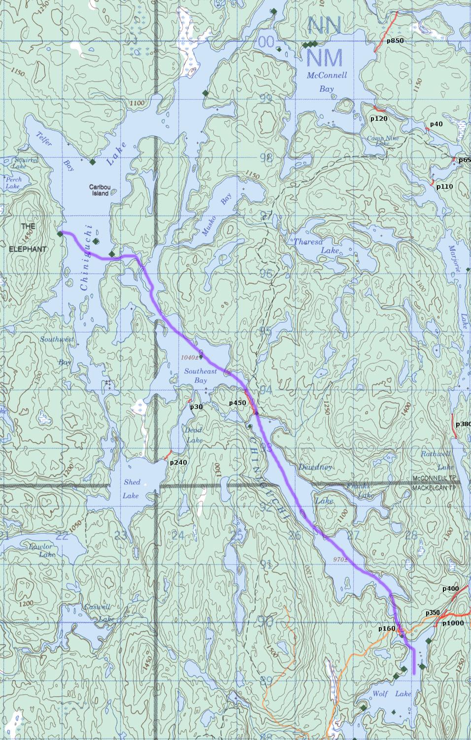
Day 2, Mon. July 22, to Chiniguchi Lake
17km: p160, p450
I had originally planned the alternate route through Marjorie, but it's much more portaging, and the portages will not be great.
Since we're not stopping on the route, we might as well take the more common and well travelled outer loop.
But, if we decide to not have a lay-over day, then we could stop on Majorie, which would be remote.
Map of this day only
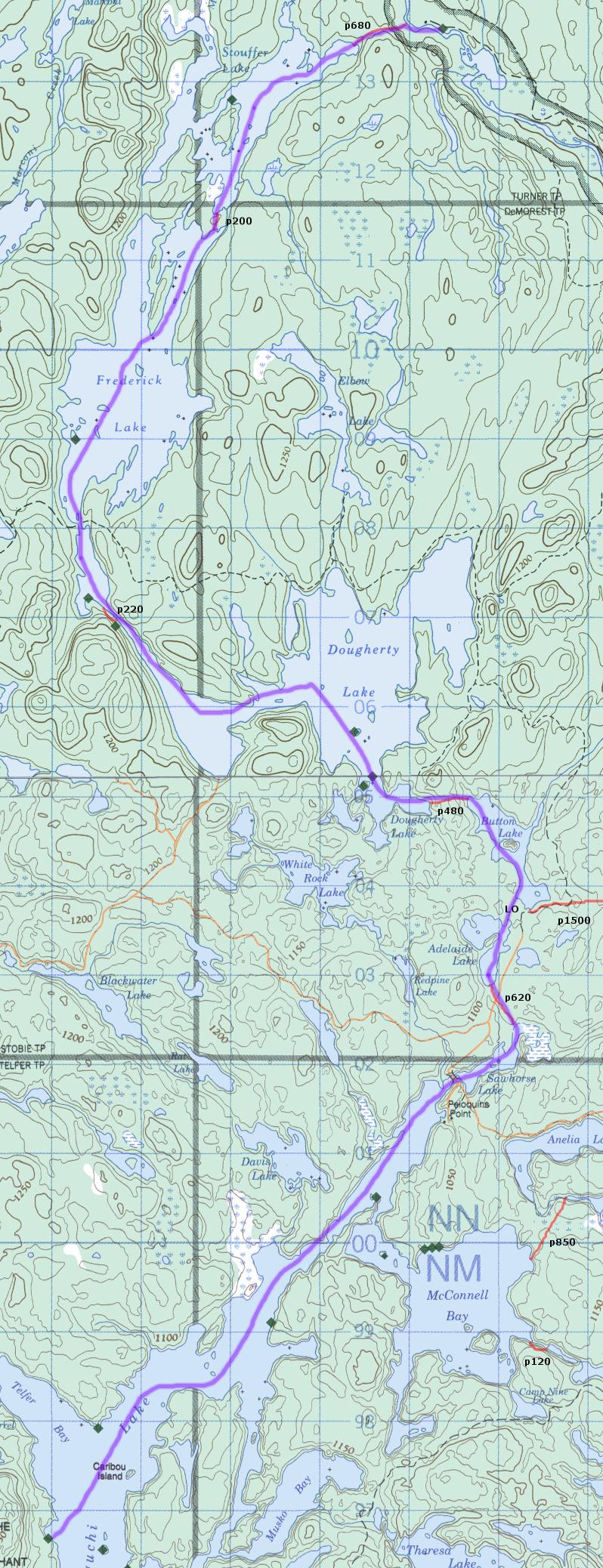
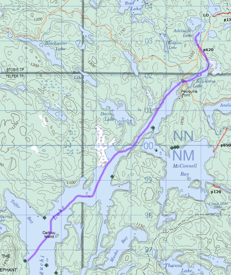
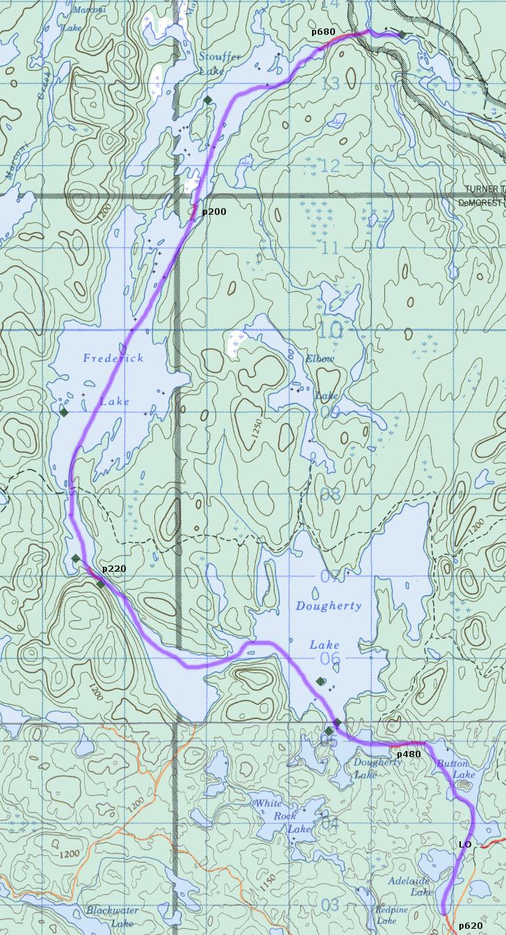
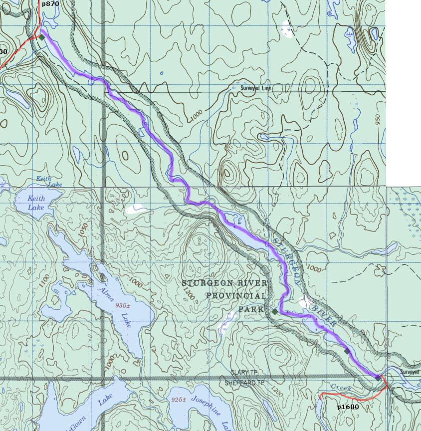
Day 3, Tues. July 23, to Sturgeon River (off Stouffer)
20km: p620, p480, p220, p200, p680
A long day, and we can stop early on Stouffer if pooped out, or if we skip the layover day.
If the camp site on the top of the Sturgeon is taken, we'd have to setup camp nearby I guess (too far to next site).
Permit required for this night.
Map of this day only
Map of this day, first half detail
Map of this day, second half detail
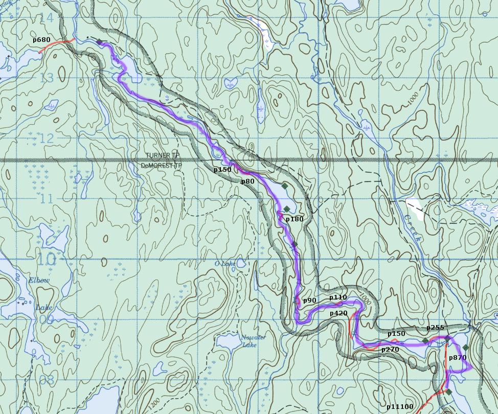
Day 4, Wed. July 24, to Sturgeon River (off Halleck Creek)
19.5km: 5 to 10 200m portages, depending on water levels and our comfort level.
Camp on the Sturgeon. Permit required for this night.
Map of this day only
Map of this day, first half detail
Map of this day, second half detail
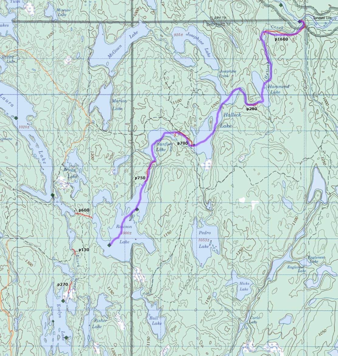
Day 5 and 6 (layover day), Thurs./Fri. July 25/26, to Rawson Lake
14km: p1600, p280, p700, p750
Probably some tough portages, not well travelled.
Map of this day only
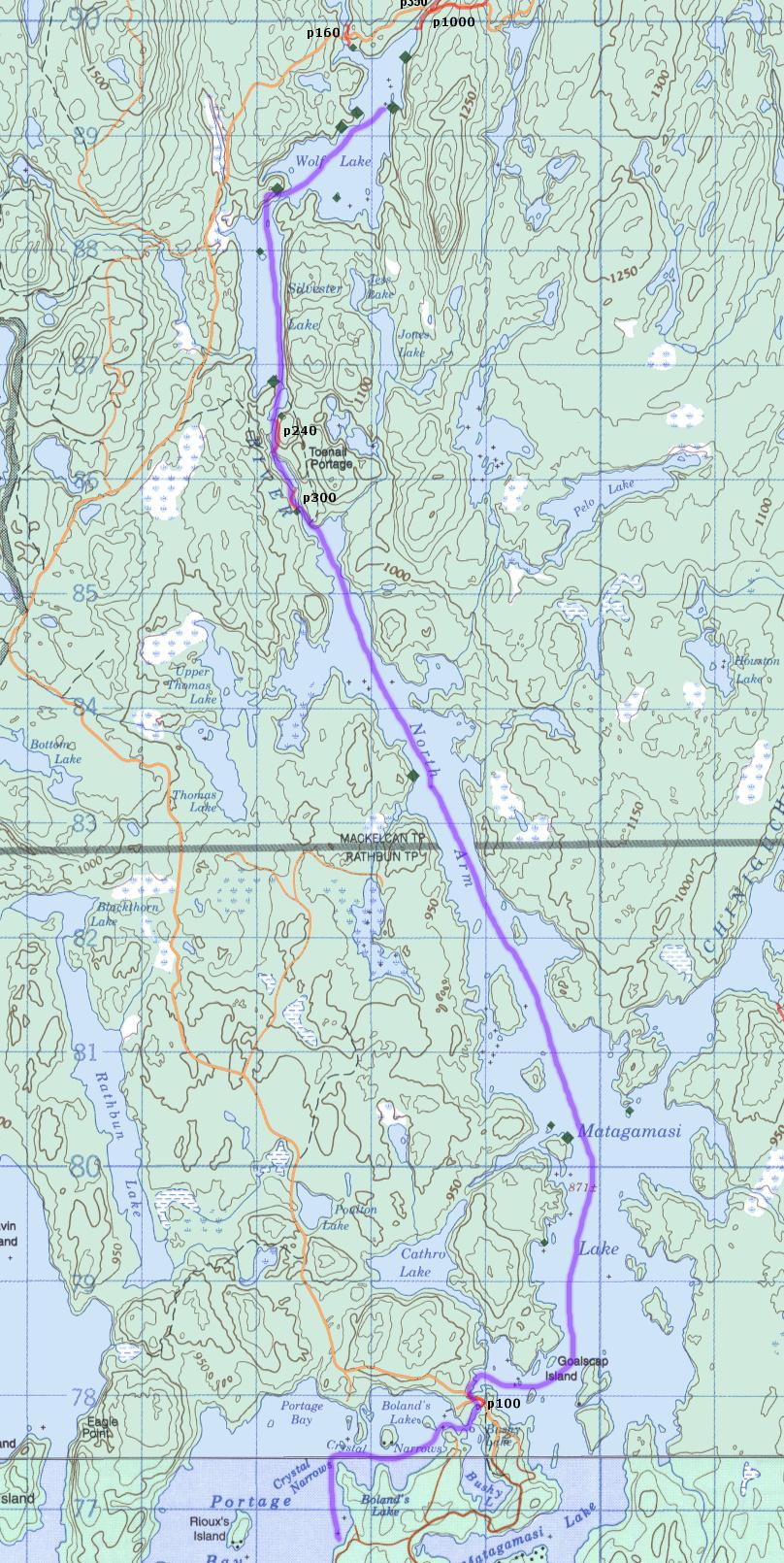
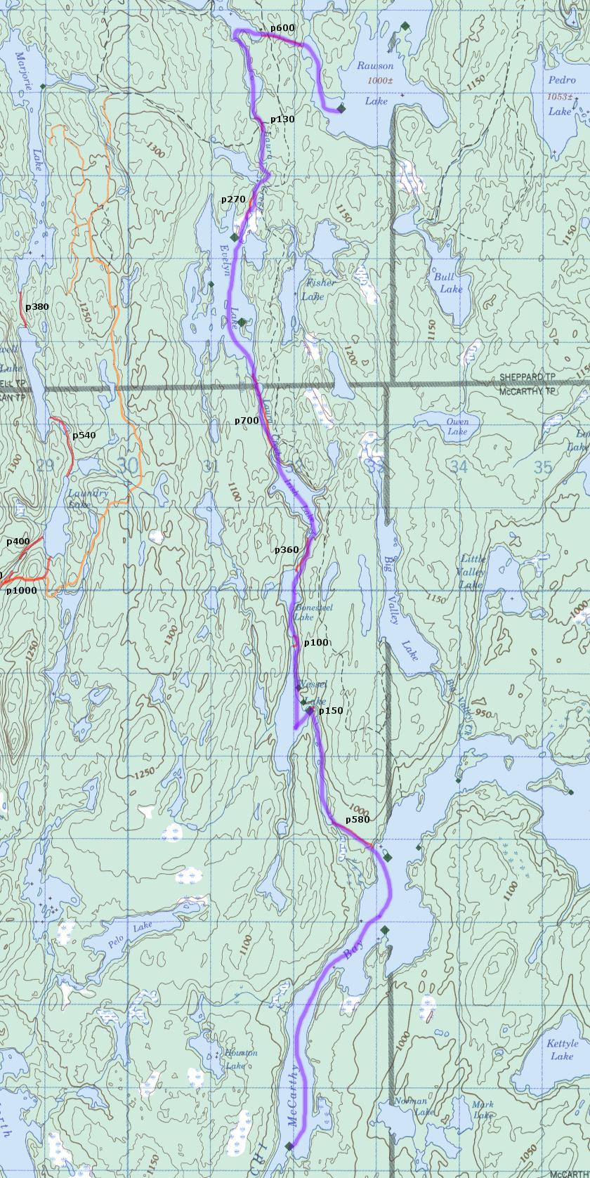
Day 7, sat. July 27, to Matagamasi Lake
15km: p600, p130, p270, p700, p360, p100, p580
Initial p600 may not be well travelled.
We could stop on Wessell to avoid crowds on Matagamasi, but I don't recall that camp site being nice.
Map of this day only
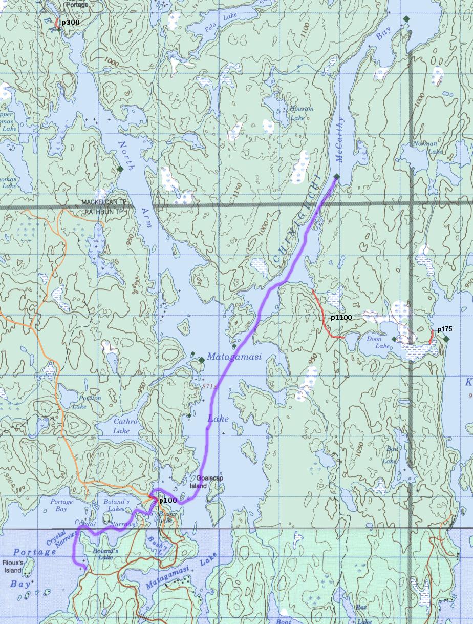
Day 8, Sun. July 28, to Access Point
10km: p100
Map of this day only
Route #3: Sturgeon River, 107km, no layover day
Alternate Route #3: Chiniguchi and Sturgeon River, with no layover day
This trip avoids heavily traveled areas, and is still a complete loop.
The Majorie Lake route (Wolfe to Chinguchi) is new and not traveled much at all, so very remote. But, we're not stopping
along the route, so it's not proving much going this way (bit harder than around west, which is more typical).
Day 1, Sun. July 22, Wolf Lake
Leave Toronto 6am.
Arrive at Lakeland Lodge at 2-3pm. Park car there ($5/day)
Wolf is a popular lake, and we arriving late. But, We're coming in on a Sunday, so I expect it won't be too bad (and there are lots of camp sites).
13km: p100, p300, p240
Day 2, Mon. July 22, to Marjorie Lake
10km: p300, p240, p1000, p700, p50
Would be isolated and quiet going this way.
Day 3, Tues. July 23, to Dougherty
14km: p150, p140, p120, p620, p480
Day 4, Wed. July 24, to Sturgeon River (mid way)
17km: p220, p200, p680, p150, p80
Day 5, Thurs. July 25, to Sturgeon River (near Halleck Creek)
14km: p180, p190, p110, p420, p270, p150, p255.
Some of these portage may not be necessary in summer, simple CI water.
Day 6, Thurs. July 25, to Rawson Lake
14km: p1600, p280, p700, p750
Probably some tough portages, not well travelled.
Day 7, Fri. July 26, to Matagamasi Lake
15km: p600, p130, p270, p700, p360, p100, p580
Initial p600 may not be well travelled.
We could stop on Wessell to avoid crowds on Matagamasi, but I don't recall that camp site being nice.
Day 8, Sat. July 27, to Access Point
10km: p100
|


